Freeware Gps Or Gis Viewer
Advertisement


GPSInfo v.1.6.0.0
Display and share all your GPS data:
*Coordinates (Latitude and Longitude)
*Speed, course (heading) and GPS Compass (only while moving)
*Altitude, GPS date and time
*Horizontal and vertical accuracy
*GPS mode (Full GPS or A-GPS)
Additional ...
Advertisement

Dubai Metro Guide v.2.0.0.0
Find Stations nearby by name, map, gps or by searching the place you want to go to. You can also find information about distance, cost and time between stations. This app also shows the timetable of each station.

Altitude v.1.1.0.0
This altimeter delivers the altitude of your current position either from the device (GPS) or from the ASTER digital elevation model (with a horizontal accuracy of 30m).
Depending on your current position and your device one of the two methods ...

Kerala Hospitals v.1.0.0.0
Open the app, switch on your GPS or select your location, this app will show you the near by hospitals.
You can call the hospitals directly from this app. You can add one hospital as your favorite hospital for easy acces or even you ...
X360 Exif & Tiff Tag Viewer ActiveX OCX
X360 Exif & Tiff Tag Viewer ActiveX Control helps developers to get all embed image information including EXIF tags, TIFF tags and GPS tags. It allows you to write useful information back to Jpeg, Png and Tiff image. Also, you can use it as a simply image ...

Eye4Software GPS Mapping Studio v.4.1
GPS Mapping Software for Windows, Loading topographic maps, realtime navigation, track recording, manage GPS devices and more. The software can be used with various map formats including: GeoTiff, BSB Nautical Charts, AutoCad DXF files, ESRI Shapefiles.
TatukGIS Viewer v.2.9.0.5307
TatukGIS Viewer opens most GIS/CAD vector, raster image, and grid file types, including the aerial imagery and vector street map data provided by the leading vendors, most ArcView, ArcExplorer, and MapInfo projects, and projects exported from ArcGIS/ArcMap ...
Free Shapefile Viewer v.5.3.1
The free AvisMap Viewer opens most GIS/CAD and raster image file types and most ArcView, ArcExplorer, and MapInfo projects. Besides just opening and viewing files, the Viewer supports an extensive list of features including visual layer properties control, ...
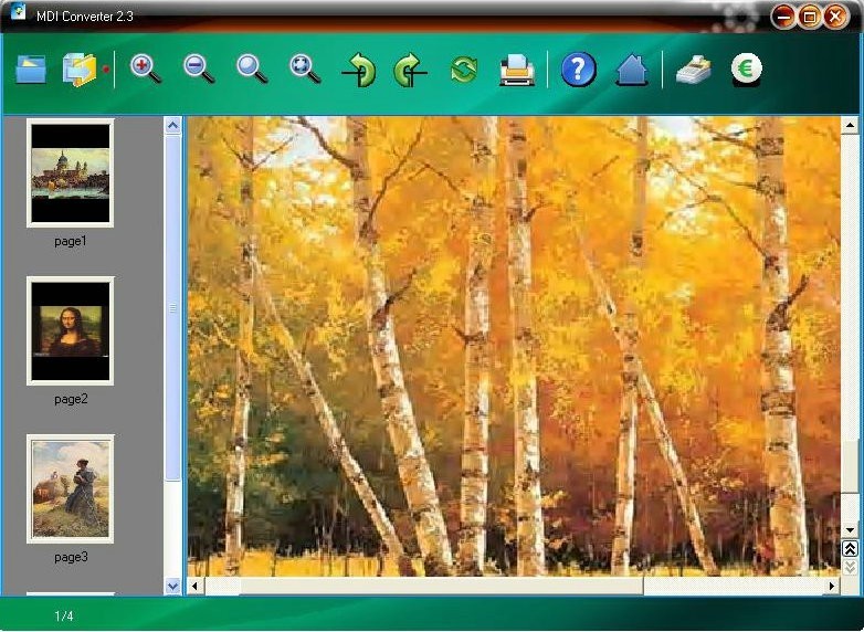
MDI Viewer v.2.9
MDI Viewer to view or convert mdi file. With MDI Converter users can convert mdi file to a single pdf document, Text file or image formats like jpg, bmp, tif and png. It also be used as other image formats converter.
Features
* Need ...
AMP Font Viewer v.3. 8. 2006
AMP Font Viewer 3.8 is the latest version of this free utility we can download directly from the developer's website. Setting up is quite easy and takes no time. We can use this application to view and manage all the fonts installed and not installed ...
Trick or Trash v.1.0
Halloween slithers closer this week with our latest freeware set. Trick or Trash, Anthony PirainoA?a‚¬a„?s latest icon release, is a Halloween-themed trash can replacement set. Creep out your Dock before itA?a‚¬a„?s too late! . Iconfactory : ...

Net Viewer v.9.335
Internet Explorer Favorites can be selectively imported to the Net Viewer database showing the list of Internet Explorer Favorites. Any Web Site Page address can be exported back to Internet Explorer Favorites. You can save Web Sites with passwords in ...
GPI to GPs converter 1.3 B013000 v.13000
Garmin POI Loader) to Google Earth (KMZ) or GPS compatible format (GPX) in a few steps. With GPI to GPs converter you are able to transform from GPI to GPs. Download your waypoints from your GPS or Palm PDAs and save it in .GPI format (Garmin Points ...
PlanetGIS Explorer v.3.0.8.5190
PlanetGIS Explorer is a free viewer for PlanetGIS maps and GIS exchange files. PlanetGIS Explorer allows you to navigate through maps, query map elements and view attribute information from linked database tables. Also PlanetGIS Explorer allows you to ...